Hong Kong Subway Maps

Hong Kong Subway Maps helps you navigate the MTR System in Hong Kong. It provides you with linear maps of every subway line and displays each station along with the possible changes you can make at them. You can also view a full map with all of the lines together.
Hong Kong Subway Maps does not require you to be connected to a Wi-Fi or a cellular data network in order to view the maps so you don’t have to worry about data charges. You'll always be able to view the maps on your iPhone or iPod Touch anywhere at anytime.
At a glance:
-
•Full MTR Subway Map
-
•Individual line maps
-
•Horizontal and vertical map view
-
•Pan around the maps by dragging with your finger
-
•Pinch to zoom on the full map
-
•Search for stations to view on the maps
-
•No network connection required for use
Current Release Version:
1.4
Price:
£0.59 GBP
$0.99 USD/CAD
€0.79 EUR
¥115 JPY
$1.19 AUD
Release Date:
29th January 2009
Category:
Travel
Requirements:
iPhone or iPod touch
iPhone OS 3.0 or newer
Support, Comments or Suggestions:

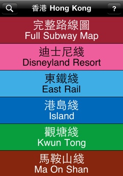
All of the Lines
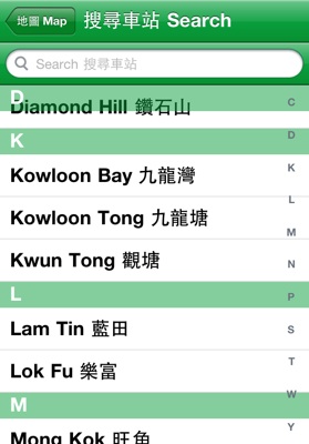
To search for a station, tap the magnifying glass button from wherever you can see it. You will be shown a list of all of the stations on that map. Tapping on a name will take you back to the map and position the station in the centre of your screen.
If you’re searching from the main map list screen, you will see all stations on the MTR network. Tapping on one will ask you which map you wish to view the station on.
To find a station, tap in the search bar at the top and type the first few characters in English of the station name. Instantly, a filtered list of stations all starting with what you typed will appear. Alternatively, you can tap or drag along the alphabet to the right of the list to jump to stations starting with that letter.
Hong Kong Subway Maps contains maps for every single line in the MTR network. You can view them by simply flicking your finger along the line, or you can view them all together in the full subway map.
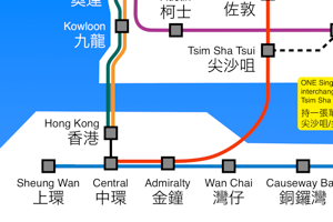
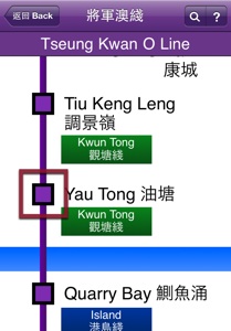
Hong Kong Subway Maps is very easy to use. To find the line you want just flick up and down on the list of lines, and then tap on the line you wish to view. To move around the line just drag your finger to scroll, or double tap to reveal controls to quickly scroll to the top, middle or bottom of the map. If you need to know what any of the symbols mean, tap the ? in the top right corner of the bar at the top. At the top of the list of lines is the “Full Subway Map” button which displays a full map of the MTR System. You can navigate around the map by dragging with your finger, or pinching with two fingers to zoom in or out.
Find Your Station!